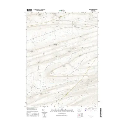
2016 Map of Woodward
USGS Topo · Published 2016About this map
Woodward serves as a primary point of reference in this landscape of high ridges and narrow gaps, situated where the floor of Penns Valley meets the rising slopes of Woodward Mtn. The topography is defined by the repetitive northeast-southwest orientation of the Appalachian Mountains, creating a series of natural corridors such as Wohlford Gap, Barner Gap, and Whetstone Gap. These passages historically dictated the movement of people and commerce through the region, connecting small settlements like Livonia and Greenburr to the larger valleys beyond. Along the steep terrain, water sources like Horse Path Spring and Cinder Pile Spring indicate the essential requirements for travelers and local agriculture in earlier eras. The presence of numerous named hollows, such as Negro Hollow and Hayes Hollow, alongside features like Buffalo Mtn, illustrates how the early inhabitants named and utilized every fold of the geography for timber, hunting, and passage.
Find a feature on this map
92 named features on this map. Tap any name to fly to it.
Don’t see what you’re looking for? This feature index may not catch every label — zoom into the map to look around manually.
Map Details
Editions of this 2016 Woodward Map
This is the sole edition of this map. No revisions or reprints were ever made.
Other maps of this area

1921 · Williamsport
USGS Topo · 1:48,000

1921 · Lock Haven
USGS Topo · 1:62,500

1923 · Lock Haven
USGS Topo · 1:62,500

1923 · Williamsport
USGS Topo · 1:62,500

1937 · Millheim
USGS Topo · 1:48,000

1938 · Mifflinburg
USGS Topo · 1:48,000

1941 · Millheim
USGS Topo · 1:62,500

1943 · Mifflinburg
USGS Topo · 1:62,500

1944 · Williamsport
USGS Topo · 1:62,500

1944 · Lock Haven
USGS Topo · 1:62,500