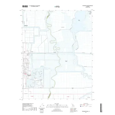
2018 Map of Woodward Island
USGS Topo · Published 2018About this map
Discovery Bay defines the southwestern portion of this landscape, its residential lagoons and inlets like Marina Bay and Cabrillo Bay carved directly into the Sacramento-San Joaquin River Delta. This modern aquatic development stands in contrast to the surrounding tract lands and islands—such as Bacon Island and Woodward Island—which are segmented by a complex network of channels including the Old River, Middle River, and Empire Cut. The geography here is a highly managed hydraulic system, evidenced by the Mokelumne Aqueduct running east-west across the center of the sheet.
Find a feature on this map
78 named features on this map. Tap any name to fly to it.
Don’t see what you’re looking for? This feature index may not catch every label — zoom into the map to look around manually.
Map Details
Editions of this 2018 Woodward Island Map
This is the sole edition of this map. No revisions or reprints were ever made.
Other maps of this area

1894 · Lodi
USGS Topo · 1:125,000

1910 · Bouldin
USGS Topo · 1:31,680

1910 · Jersey
USGS Topo · 1:31,680

1910 · Headreach
USGS Topo · 1:31,680

1911 · Byron Hot Springs
USGS Topo · 1:31,680

1913 · Woodward Island
USGS Topo · 1:31,680

1913 · Holt
USGS Topo · 1:31,680

1914 · Brentwood
USGS Topo · 1:31,680

1914 · Bethany
USGS Topo · 1:31,680

1914 · Union Island
USGS Topo · 1:31,680