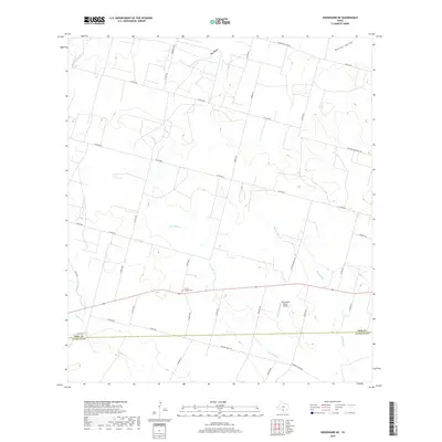
2019 Map of Woodward NE
USGS Topo · Published 2019About this map
Dry Cibolo Cr and Mitchell Br define the drainage of this brushy South Texas landscape along the county line. The rural character of the region is evident in the network of county roads like Copps Rd and Urban Rd that cross a terrain marked by substantial drainages like Big Hollow and Panther Hollow. Local history is anchored at the Chapel Cem, while the Mc Donald Ranch Airport suggests the integration of private aviation into large-scale ranching operations. The transition from Frio Co to La Salle Co in the southern portion of the sheet illustrates the jurisdictional boundaries of the Brush Country. This modern survey reflects a landscape still largely dedicated to ranching and rural transit, with family-named routes such as Pancho Garcia Rd and Ventura Gonzalez Rd providing a window into local land ownership and heritage.
Find a feature on this map
40 named features on this map. Tap any name to fly to it.
Don’t see what you’re looking for? This feature index may not catch every label — zoom into the map to look around manually.
Map Details
Editions of this 2019 Woodward NE Map
This is the sole edition of this map. No revisions or reprints were ever made.
Other maps of this area

1925 · Pearsall 1-c
USGS Topo · 1:48,000

1927 · Pearsall
USGS Topo · 1:62,500

1942 · Divot
USGS Topo · 1:62,500

1942 · Dilley
USGS Topo · 1:62,500

1953 · Crystal City
USGS Topo · 1:250,000

1955 · Crystal City
USGS Topo · 1:250,000

1956 · Woodward
USGS Topo · 1:62,500

1956 · Divot
USGS Topo · 1:62,500

1961 · Crystal City
USGS Topo · 1:250,000
1964 · Derby
USGS Topo · 1:24,000