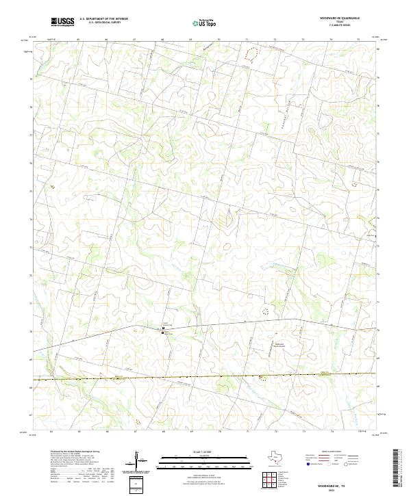
2022 Map of Woodward NE
USGS Topo · Published 2022About this map
Saint Mary's Cem and the adjacent Covey Chapel Cem mark a quiet high point in the south-central portion of this South Texas landscape. This rural survey reveals a terrain defined by intermittent drainages and ranch infrastructure along the border of Frio and La Salle counties. The land is dissected by numerous local roads and branches of the Cibolo river system, including Dry Cibolo Cr and Big Hollow Cr, which carve through the south-sloping brush country. To the east, the remote Hugo Cem sits near the headwaters of Mitchell Br, while the McDonald Ranch Airport indicates the modern scale of local aviation and large-acreage land management. The concentration of cemeteries in an otherwise sparsely populated area provides a significant map for genealogists tracing South Texas families in the Woodward vicinity.
Find a feature on this map
42 named features on this map. Tap any name to fly to it.
Don’t see what you’re looking for? This feature index may not catch every label — zoom into the map to look around manually.
Map Details
Editions of this 2022 Woodward NE Map
This is the sole edition of this map. No revisions or reprints were ever made.
Other maps of this area

1925 · Pearsall 1-c
USGS Topo · 1:48,000

1927 · Pearsall
USGS Topo · 1:62,500

1942 · Divot
USGS Topo · 1:62,500

1942 · Dilley
USGS Topo · 1:62,500

1953 · Crystal City
USGS Topo · 1:250,000

1955 · Crystal City
USGS Topo · 1:250,000

1956 · Woodward
USGS Topo · 1:62,500

1956 · Divot
USGS Topo · 1:62,500

1961 · Crystal City
USGS Topo · 1:250,000
1964 · Derby
USGS Topo · 1:24,000