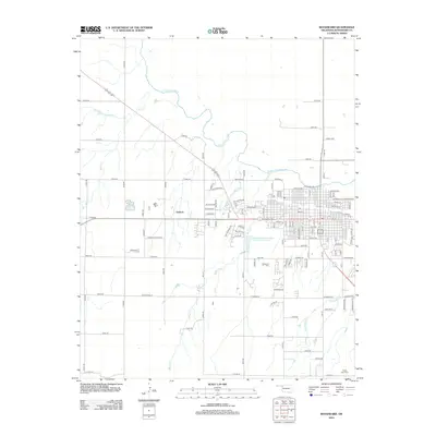
2012 Map of Woodward
USGS Topo · Published 2012About this map
The N Canadian River snakes across this landscape, defining the topography north of the growing street grid. The settlement at Gerlach and the residential area of Sandy Hvn sit on the periphery of the primary town center, which is anchored by a dense network of thoroughfares like Main St and Canadian Ave. This 2012 snapshot of the region captures the institutional presence of the Woodward Beauty Coll and the research-oriented Southern Great Plains Field Station Lake. Genealogists will find the locations of Elmwood Cem and Prairie View Cem essential for tracing local family histories. The drainage patterns of Woodward Cr, Spring Cr, and Roundup Cr illustrate the natural hydrology that influenced the layout of rural roads such as E0410 Rd and the long southern stretch of E Co Rd 44.
Find a feature on this map
59 named features on this map. Tap any name to fly to it.
Don’t see what you’re looking for? This feature index may not catch every label — zoom into the map to look around manually.
Map Details
Editions of this 2012 Woodward Map
This is the sole edition of this map. No revisions or reprints were ever made.
Other maps of this area

1955 · Woodward
USGS Topo · 1:250,000

1958 · Woodward
USGS Topo · 1:250,000

1969 · Fargo
USGS Topo · 1:24,000

1969 · Woodward SW
USGS Topo · 1:24,000

1969 · Woodward
USGS Topo · 1:24,000

1969 · Sharon
USGS Topo · 1:24,000

1969 · Fargo SE
USGS Topo · 1:24,000

1969 · Woodward NE
USGS Topo · 1:24,000

1970 · Sleeping Bear Creek SW
USGS Topo · 1:24,000

1970 · Sleeping Bear Creek SE
USGS Topo · 1:24,000