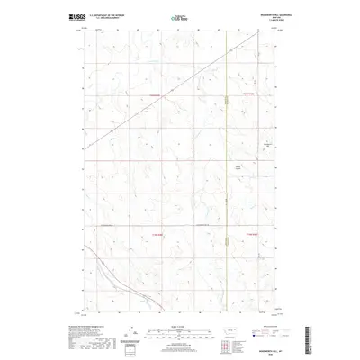
2020 Map of Woodworth Hill
USGS Topo · Published 2020About this map
Woodworth Hill rises above a landscape defined by the drainage networks of the Missouri River watershed, marking a rugged intersection of eastern Montana's prairie and badlands terrain. This 2020 survey documents the border region between McCone and Dawson counties, where the high ground of Stilson Coulee gives way to a complex series of intermittent watercourses including Cottonwood Creek and Buffalo Springs Creek. The area is characterized by vast open range and section-line grazing land, with human activity centered along the path of Cottonwood Creek Road. This modern topographical study captures the enduring rural character of the region, providing precise data on the elevation changes and hydrography near Sioux Creek and Gyp Creek that have shaped land use and ranching boundaries for generations.
Find a feature on this map
13 named features on this map. Tap any name to fly to it.
Don’t see what you’re looking for? This feature index may not catch every label — zoom into the map to look around manually.
Map Details
Editions of this 2020 Woodworth Hill Map
This is the sole edition of this map. No revisions or reprints were ever made.
Other maps of this area

1954 · Glendive
USGS Topo · 1:250,000

1957 · Glendive
USGS Topo · 1:250,000

1958 · Glendive
USGS Topo · 1:250,000

1982 · Circle
USGS Topo · 1:100,000

1983 · Woodworth Hill
USGS Topo · 1:24,000

1983 · Olson Coulee South
USGS Topo · 1:24,000

1983 · Mount Antelope
USGS Topo · 1:24,000

1983 · Quick Reservoir
USGS Topo · 1:24,000

1983 · Buffalo Creek
USGS Topo · 1:24,000

1983 · Circle
USGS Topo · 1:24,000