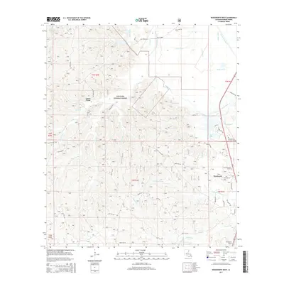
2015 Map of Woodworth West
USGS Topo · Published 2015About this map
Kisatchie National Forest dominates this section of Rapides Parish, defining a landscape of dense pine woods and intricate drainage networks. The terrain is carved by numerous waterways, including the winding Bayou Boeuf and the Castor Cr that feeds into Castor Plunge. While the western portion of the map is characterized by this protected woodland, the eastern edge shows more development where the forest meets the town of Woodworth. Local landmarks such as Alexander Memorial Gardens and Sunrise Memorial Gardens are situated near the community, providing valuable points of reference for genealogists. The presence of the Woodworth Airport and the Diversion Channel to the northeast illustrates the modern infrastructure integrated into the river-and-forest economy of central Louisiana. Extensive forest routes, such as Forest Rte 277, provide a detailed view of the access points through the timberlands.
Find a feature on this map
54 named features on this map. Tap any name to fly to it.
Don’t see what you’re looking for? This feature index may not catch every label — zoom into the map to look around manually.
Map Details
Editions of this 2015 Woodworth West Map
This is the sole edition of this map. No revisions or reprints were ever made.
Other maps of this area

1932 · Boyce SW
USGS Topo · 1:31,680

1935 · Lecompte
USGS Topo · 1:62,500

1941 · Alexandria
USGS Topo · 1:62,500

1941 · Boyce
USGS Topo · 1:62,500

1945 · Boyce SE
USGS Topo · 1:31,680

1949 · Boyce SE
USGS Topo · 1:31,680

1953 · Alexandria
USGS Topo · 1:250,000

1955 · Alexandria
USGS Topo · 1:250,000

1956 · Forest Hill
USGS Topo · 1:62,500

1956 · Boyce
USGS Topo · 1:62,500