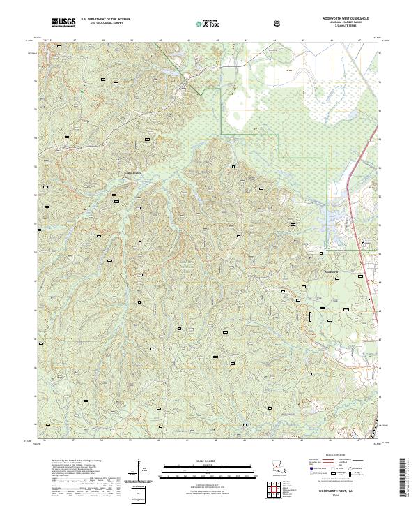
2024 Map of Woodworth West
USGS Topo · Published 2024About this map
Kisatchie National Forest defines the character of this Rapides Parish landscape, where dense drainage networks like Big Brushy Creek and Little Loving Creek carve through the wooded terrain. The settlement of Woodworth sits on the eastern edge of the forest, serving as a gateway to a labyrinth of forest routes and recreational paths. Significant trail systems, including the winding Wild Azalea Tr and Claiborne North Trl, provide access to the interior, reflecting the area's long-standing role as a timber and conservation resource. Near the community of Castor Plunge, the land is marked by numerous seasonal branches such as Cypress Branch and Long Branch. This modern survey also documents established memorial sites including Alexander Memorial Gardens and Sunrise Memorial Gardens, offering a precise record of local land use where the managed forest meets the expanding outskirts of neighboring communities.
Find a feature on this map
54 named features on this map. Tap any name to fly to it.
Don’t see what you’re looking for? This feature index may not catch every label — zoom into the map to look around manually.
Map Details
Editions of this 2024 Woodworth West Map
This is the sole edition of this map. No revisions or reprints were ever made.
Other maps of this area

1932 · Boyce SW
USGS Topo · 1:31,680

1935 · Lecompte
USGS Topo · 1:62,500

1941 · Alexandria
USGS Topo · 1:62,500

1941 · Boyce
USGS Topo · 1:62,500

1945 · Boyce SE
USGS Topo · 1:31,680

1949 · Boyce SE
USGS Topo · 1:31,680

1953 · Alexandria
USGS Topo · 1:250,000

1955 · Alexandria
USGS Topo · 1:250,000

1956 · Forest Hill
USGS Topo · 1:62,500

1956 · Boyce
USGS Topo · 1:62,500