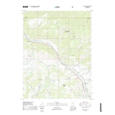
2019 Map of Woody Creek
USGS Topo · Published 2019About this map
The Roaring Fork River valley carves through this portion of Pitkin County, serving as the central corridor for the Rio Grande Trail and numerous water management systems. The complex network of irrigation features, including the Walker Wonder Ditch, Wheatley Western Ditch, and Salvation Ditch, illustrates the long history of water engineering required to sustain mountain agriculture and development. On the valley floor, the Wheatley Cem sits near the original Snowmass settlement, while the modern growth of Snowmass Village and the proximity of the Aspen Airport signal the area's contemporary evolution. To the north and east, the landscape rises sharply into the White River National Forest, defined by prominent summits such as Sloane Peak and Triangle Peak. The map also captures the transition between Eagle and Pitkin counties along the high ridges of the Arbaney-Kittle area.
Find a feature on this map
98 named features on this map. Tap any name to fly to it.
Don’t see what you’re looking for? This feature index may not catch every label — zoom into the map to look around manually.
Map Details
Editions of this 2019 Woody Creek Map
This is the sole edition of this map. No revisions or reprints were ever made.
Other maps of this area

1893 · Aspen
USGS Topo · 1:62,500

1895 · Aspen
USGS Topo · 1:62,500

1909 · Mount Jackson
USGS Topo · 1:125,000

1911 · Mount Jackson
USGS Topo · 1:125,000

1957 · Leadville
USGS Topo · 1:250,000

1959 · Leadville
USGS Topo · 1:250,000

1960 · Leadville
USGS Topo · 1:250,000

1960 · Highland Peak
USGS Topo · 1:24,000

1960 · Capitol Peak
USGS Topo · 1:24,000

1960 · Aspen
USGS Topo · 1:24,000