2022 Map of Woody Creek
USGS Topo · Published 2022About this map
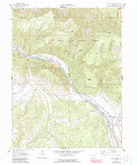
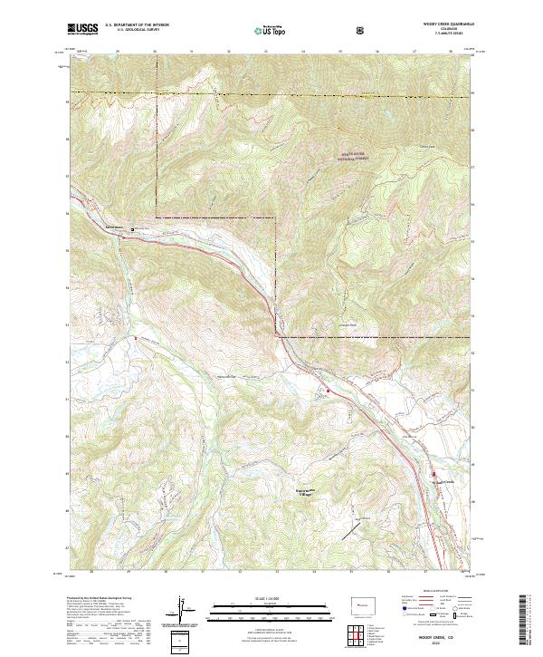
White River National Forest dominates the high ground of this Pitkin County landscape, where the Roaring Fork River carves a central valley between Snowmass and Woody Creek. The complex water management of the region is evident in the extensive network of gravity-fed irrigation channels, including the Wheatley-Western Ditch, Williams Ditch Number 2, and the Salvation Ditch, which trace the contours of the Watson Divide and surrounding gulches. These systems historically supported the ranching and agricultural operations that preceded the modern mountain communities.
Find a feature on this map
81 named features on this map. Tap any name to fly to it.
Don’t see what you’re looking for? This feature index may not catch every label — zoom into the map to look around manually.
Map Details
Editions of this 2022 Woody Creek Map
This is the sole edition of this map. No revisions or reprints were ever made.
Historical Maps of Snowmass Village Through Time
6 maps found