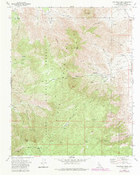
1972 Map of Woolstalf Creek
USGS Topo · Published 1986About this map
The Sierra Nevada Mountains dominate this high-altitude landscape where the Sequoia National Forest meets the arid basins of eastern Kern County. In the early 1970s, this area retained the hallmarks of early ranching and mining history, centered around the Bob Rabbit Place and the cattle-grazing grounds of Bob Rabbit Meadow and Woolstalf Mdw. The map documents a rugged interior accessible primarily by a network of Pack Trails and Jeep Trails that connect these meadows to the towering heights of Nicolls Peak and Heald Peak.
Find a feature on this map
39 named features on this map. Tap any name to fly to it.
Don’t see what you’re looking for? This feature index may not catch every label — zoom into the map to look around manually.
Map Details
Editions of this 1972 Woolstalf Creek Map
2 editions found
Other maps of this area

1906 · Kernville
USGS Topo · 1:125,000

1908 · Kernville
USGS Topo · 1:125,000

1915 · Mojave
USGS Topo · 1:125,000

1943 · Cross Mountain
USGS Topo · 1:62,500

1943 · Emerald Mtn
USGS Topo · 1:62,500

1943 · Onyx
USGS Topo · 1:62,500

1943 · Isabella
USGS Topo · 1:62,500

1948 · Bakersfield
USGS Topo · 1:250,000

1955 · Bakersfield
USGS Topo · 1:250,000

1956 · Bakersfield
USGS Topo · 1:250,000