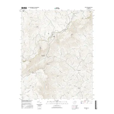
2016 Map of Woolwine
USGS Topo · Published 2016About this map
The Blue Ridge Parkway meanders across the high elevations of the Blue Ridge, following the crest through the borderlands of Floyd and Patrick counties. This 2016 survey captures a landscape of steep mountain spurs and deep river valleys, where small settlements like Woolwine and Tuggles Gap anchor the local community. The drainage patterns of the N Fork Smith River and Jacks Cr dominate the southern half of the map, carving paths between peaks such as Twelve O'Clock Knob and Tinsley Knob.
Find a feature on this map
99 named features on this map. Tap any name to fly to it.
Don’t see what you’re looking for? This feature index may not catch every label — zoom into the map to look around manually.
Map Details
Editions of this 2016 Woolwine Map
This is the sole edition of this map. No revisions or reprints were ever made.
Other maps of this area

1926 · Critz
USGS Topo · 1:48,000

1928 · Stuart
USGS Topo · 1:48,000

1928 · Critz
USGS Topo · 1:62,500

1931 · Stuart
USGS Topo · 1:62,500

1953 · Winston-Salem
USGS Topo · 1:250,000

1955 · Winston-Salem
USGS Topo · 1:250,000

1957 · Endicott
USGS Topo · 1:62,500

1957 · Floyd
USGS Topo · 1:62,500

1962 · Winston-Salem
USGS Topo · 1:250,000

1967 · Patrick Springs
USGS Topo · 1:24,000