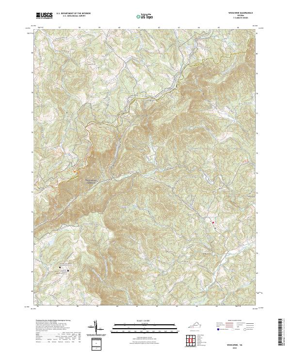
2022 Map of Woolwine
USGS Topo · Published 2022About this map
The Blue Ridge Parkway meanders along the dividing line between Floyd and Patrick Counties, following the crest of the Blue Ridge Mountains through this rural Virginia landscape. At high elevations, notable crossings like Tuggles Gap and Woods Gap serve as historical transition points between the mountain plateaus and the river valleys below. The map shows a landscape deeply defined by its drainage basins, where the headwaters of the Smith River and Dan River begin their descent. Small rural congregations and family histories are anchored at sites like the Mountain View United Methodist Church Cem and Conners View Primitive Baptist Church Cem. Near the northern boundary, Rakes Millpond marks an area of historical water utilization, while numerous creeks like Rock Castle Cr and Widgeon Creek carve out the hollows that define the local road network.
Find a feature on this map
96 named features on this map. Tap any name to fly to it.
Don’t see what you’re looking for? This feature index may not catch every label — zoom into the map to look around manually.
Map Details
Editions of this 2022 Woolwine Map
This is the sole edition of this map. No revisions or reprints were ever made.
Other maps of this area

1926 · Critz
USGS Topo · 1:48,000

1928 · Stuart
USGS Topo · 1:48,000

1928 · Critz
USGS Topo · 1:62,500

1931 · Stuart
USGS Topo · 1:62,500

1953 · Winston-Salem
USGS Topo · 1:250,000

1955 · Winston-Salem
USGS Topo · 1:250,000

1957 · Endicott
USGS Topo · 1:62,500

1957 · Floyd
USGS Topo · 1:62,500

1962 · Winston-Salem
USGS Topo · 1:250,000

1967 · Patrick Springs
USGS Topo · 1:24,000