
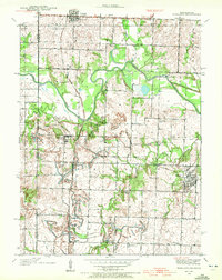
1938 Map of Worland
USGS Topo · Published 1954About this map
Amoret, Worland, and Foster anchor this 1930s landscape along the Missouri-Kansas border, where the Linn Co Bates Co line follows a network of railroads and winding waterways. The Kansas City Southern and Missouri Pacific lines intersect the terrain, reflecting the era's heavy reliance on rail for moving goods across the Osage River valley. The hydrology is dominated by the Osage River and its tributaries, including Mulberry Creek and Walnut Creek, while the Bates County Drainage Ditch indicates early 20th-century efforts to manage the river's floodplain for agricultural use.
Find a feature on this map
33 named features on this map. Tap any name to fly to it.
Don’t see what you’re looking for? This feature index may not catch every label — zoom into the map to look around manually.
Map Details
Editions of this 1938 Worland Map
3 editions found
Other maps of this area

1887 · Butler
USGS Topo · 1:125,000

1887 · Mound City
USGS Topo · 1:125,000

1893 · Mound City
USGS Topo · 1:125,000

1894 · Butler
USGS Topo · 1:125,000

1937 · New Home
USGS Topo · 1:24,000

1940 · Worland
USGS Topo · 1:24,000

1940 · Hume
USGS Topo · 1:24,000

1942 · Hume
USGS Topo · 1:24,000
1942 · Sprague
USGS Topo · 1:24,000

1947 · Lawrence
USGS Topo · 1:250,000