
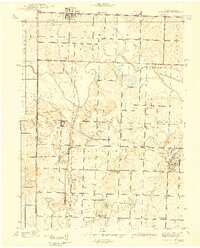
1940 Map of Worland
USGS Topo · Published 1940About this map
The borderlands of Missouri and Kansas in the late 1930s were defined by a rigorous grid of section lines and the diverging paths of the Kansas City Southern and Missouri Pacific railroads. Centered on the town of Worland, this landscape demonstrates the dense rural infrastructure of a pre-war agricultural economy, where one-room schools like Klondike Sch and Victory Sch served localized farm clusters every few miles.
Find a feature on this map
29 named features on this map. Tap any name to fly to it.
Don’t see what you’re looking for? This feature index may not catch every label — zoom into the map to look around manually.
Map Details
Editions of this 1940 Worland Map
2 editions found
Other maps of this area

1887 · Butler
USGS Topo · 1:125,000

1887 · Mound City
USGS Topo · 1:125,000

1893 · Mound City
USGS Topo · 1:125,000

1894 · Butler
USGS Topo · 1:125,000

1937 · New Home
USGS Topo · 1:24,000

1938 · Worland
USGS Topo · 1:24,000

1940 · Hume
USGS Topo · 1:24,000

1942 · Hume
USGS Topo · 1:24,000
1942 · Sprague
USGS Topo · 1:24,000

1947 · Lawrence
USGS Topo · 1:250,000