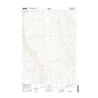
2015 Map of Worland SE
USGS Topo · Published 2015About this map
Tolman Sand Cr Reservoir and Clydeos Reservoir provide essential water management points in this arid stretch of Washakie County. The drainage network is defined by the winding course of Sand Cr and its tributary E Fork Sand Cr, alongside the southwest-trending Slick Cr. This 2015 survey reveals a landscape largely shaped by topography and rural access, where thoroughfares like Bonanza Rd and Rattlesnake Ridge Rd navigate the high desert terrain. The area is characterized by low-density infrastructure, with local routes such as Cactus Dr and Marconi Rd serving the interior rangelands. The survey highlights the significant role of small-scale reservoirs in supporting the local environment and land use patterns throughout the Big Horn Basin region.
Find a feature on this map
15 named features on this map. Tap any name to fly to it.
Don’t see what you’re looking for? This feature index may not catch every label — zoom into the map to look around manually.
Map Details
Editions of this 2015 Worland SE Map
This is the sole edition of this map. No revisions or reprints were ever made.
Other maps of this area

1955 · Sheridan
USGS Topo · 1:250,000

1955 · Arminto
USGS Topo · 1:250,000

1958 · Sheridan
USGS Topo · 1:250,000

1958 · Arminto
USGS Topo · 1:250,000

1962 · Sheridan
USGS Topo · 1:250,000

1962 · Arminto
USGS Topo · 1:250,000
1966 · Banjo Flats West
USGS Topo · 1:24,000

1966 · Cabin Fork
USGS Topo · 1:24,000
1966 · Banjo Flats East
USGS Topo · 1:24,000
1967 · Weintz Draw
USGS Topo · 1:24,000