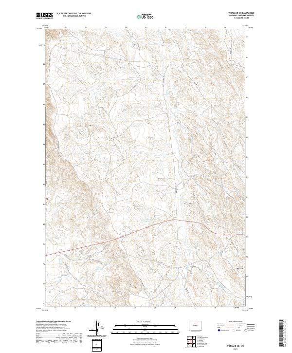
2021 Map of Worland SE
USGS Topo · Published 2021About this map
Arid basin topography southeast of Worland defines this modern survey of central Wyoming. The landscape is marked by seasonal drainages and water management features critical to the region's ranching and resource history, including the Tolman Sand Cr Reservoir and the Clydeos Reservoir. These catchments collect runoff from systems like Sand Cr and Slick Cr, which carve through the local ridges.
Find a feature on this map
19 named features on this map. Tap any name to fly to it.
Don’t see what you’re looking for? This feature index may not catch every label — zoom into the map to look around manually.
Map Details
Editions of this 2021 Worland SE Map
This is the sole edition of this map. No revisions or reprints were ever made.
Other maps of this area

1955 · Sheridan
USGS Topo · 1:250,000

1955 · Arminto
USGS Topo · 1:250,000

1958 · Sheridan
USGS Topo · 1:250,000

1958 · Arminto
USGS Topo · 1:250,000

1962 · Sheridan
USGS Topo · 1:250,000

1962 · Arminto
USGS Topo · 1:250,000
1966 · Banjo Flats West
USGS Topo · 1:24,000

1966 · Cabin Fork
USGS Topo · 1:24,000
1966 · Banjo Flats East
USGS Topo · 1:24,000
1967 · Weintz Draw
USGS Topo · 1:24,000