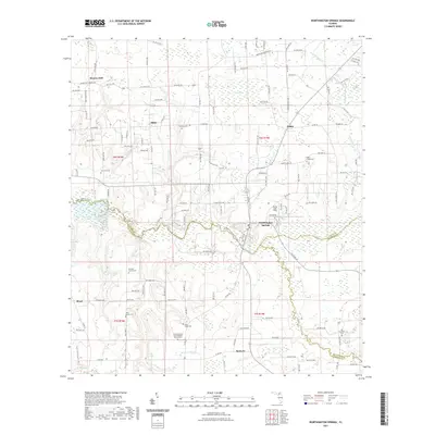
2021 Map of Worthington Springs
USGS Topo · Published 2021About this map
Worthington Springs serves as the focal point of this North Florida landscape, situated where the Santa Fe River and the New River converge. This 2021 survey shows a region defined by agricultural plots, dense wetlands, and a deep genealogical record. Numerous family and community burial sites are scattered across the terrain, including the Richard Family Cem, Davis Family Cem, and Old Bradford Cem. The northern portion of the map is marked by rural crossroads like Dukes and Miller, while the eastern edge features Dekles Millpond. Aviation history is present at Flying Tiger Field north of the main settlement. The abundance of churches and cemeteries, such as the North Pleasant Grove Baptist Church Cem, provides a clear view of the established social fabric of Union and Alachua counties.
Find a feature on this map
134 named features on this map. Tap any name to fly to it.
Don’t see what you’re looking for? This feature index may not catch every label — zoom into the map to look around manually.
Map Details
Editions of this 2021 Worthington Springs Map
This is the sole edition of this map. No revisions or reprints were ever made.
Other maps of this area

1954 · Gainesville
USGS Topo · 1:250,000

1954 · Valdosta
USGS Topo · 1:250,000

1958 · Valdosta
USGS Topo · 1:250,000

1958 · Gainesville
USGS Topo · 1:250,000

1959 · Valdosta
USGS Topo · 1:250,000

1959 · Gainesville
USGS Topo · 1:250,000

1962 · High Springs
USGS Topo · 1:24,000

1962 · Mikesville
USGS Topo · 1:24,000

1963 · Ellisville
USGS Topo · 1:24,000

1966 · Lake Butler
USGS Topo · 1:24,000