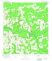
1966 Map of Worthington Springs
USGS Topo · Published 1967About this map
Worthington Springs sits at the confluence of the Santa Fe River and New River, serving as a central hub for the surrounding rural communities of Union, Bradford, and Alachua counties in the mid-1960s. The landscape is defined by the Atlantic Coast Line railroad and a network of timber and agricultural sites like Browns Still and Dekles Millpond. Numerous country churches and family burial grounds are distributed across the terrain, including Little Springs Ch, Harmony Ch, and the Bethany Cem. Small settlements like Dukes, Miller, and Bland represent the dispersed nature of Florida's interior north of Gainesville during this era, before major interstate development altered the local transit patterns.
Find a feature on this map
33 named features on this map. Tap any name to fly to it.
Don’t see what you’re looking for? This feature index may not catch every label — zoom into the map to look around manually.
Map Details
Editions of this 1966 Worthington Springs Map
This is the sole edition of this map. No revisions or reprints were ever made.
Other maps of this area

1954 · Gainesville
USGS Topo · 1:250,000

1954 · Valdosta
USGS Topo · 1:250,000

1958 · Valdosta
USGS Topo · 1:250,000

1958 · Gainesville
USGS Topo · 1:250,000

1959 · Valdosta
USGS Topo · 1:250,000

1959 · Gainesville
USGS Topo · 1:250,000

1962 · High Springs
USGS Topo · 1:24,000

1962 · Mikesville
USGS Topo · 1:24,000

1963 · Ellisville
USGS Topo · 1:24,000

1966 · Lake Butler
USGS Topo · 1:24,000