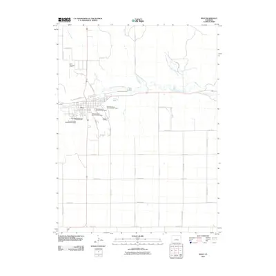
2010 Map of Wray
USGS Topo · Published 2010About this map
The city of Wray serves as the focal point of this Eastern Plains landscape, situated where the North Fork Republican River cuts through the high plateau. The town is marked by a clear transition from the residential street grid, including Blake St and W North Railway St, to the surrounding agricultural sections. A complex system of water management is evident just outside the city limits, featuring several numbered structures such as Wray Watershed District Number 1 Dam and Wray Watershed District Number 6 Dam. These dams, alongside the Laird Canal and Haigler Canal, illustrate the critical importance of irrigation and flood control in this river valley. To the east of the town center, Olive Lake and Grandview Cemetery provide prominent local landmarks, while the Wray Municipal Airport sits on the higher ground to the northwest. The surrounding terrain is defined by a series of north-south drainage creeks including Holy Joe Creek, Hayes Creek, and Bloom Creek.
Find a feature on this map
33 named features on this map. Tap any name to fly to it.
Don’t see what you’re looking for? This feature index may not catch every label — zoom into the map to look around manually.
Map Details
Editions of this 2010 Wray Map
This is the sole edition of this map. No revisions or reprints were ever made.
Other maps of this area

1954 · Limon
USGS Topo · 1:250,000

1954 · Sterling
USGS Topo · 1:250,000

1957 · Limon
USGS Topo · 1:250,000

1958 · Limon
USGS Topo · 1:250,000

1958 · Sterling
USGS Topo · 1:250,000

1961 · Robb
USGS Topo · 1:24,000

1961 · Laird
USGS Topo · 1:24,000

1961 · Wray
USGS Topo · 1:24,000

1963 · Vernon
USGS Topo · 1:24,000

1963 · Beecher Island NW
USGS Topo · 1:24,000