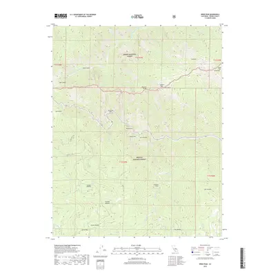
2018 Map of Wren Peak
USGS Topo · Published 2018About this map
The Sierra National Forest and Sequoia National Forest converge in this high-altitude landscape dominated by the Monarch Divide and Junction Ridge. The northern territory is carved by the Middle Fork Kings River, which passes through sharp topographical drops at Brush Canyon and Deer Canyon. To the south, the terrain levels into several significant high-elevation meadows, including Tornado Meadow, Burton Meadow, and Kennedy Meadow, suggesting a traditional pattern of seasonal drainage and grazing lands. Transport is limited to rugged routes such as Forest Rte 13S06 and Forest Rte 13S05, which navigate the steep transition from Yucca Point toward the interior peaks. Notable landmarks like Wren Peak and the geological formation of the Grand Dike define the eastern boundary of this wilderness area.
Find a feature on this map
40 named features on this map. Tap any name to fly to it.
Don’t see what you’re looking for? This feature index may not catch every label — zoom into the map to look around manually.
Map Details
Editions of this 2018 Wren Peak Map
This is the sole edition of this map. No revisions or reprints were ever made.
Other maps of this area

1903 · Tehipite
USGS Topo · 1:125,000

1905 · Tehipite
USGS Topo · 1:125,000

1948 · Fresno
USGS Topo · 1:250,000

1952 · Tehipite Dome
USGS Topo · 1:62,500

1953 · Marion Peak
USGS Topo · 1:62,500

1955 · Fresno
USGS Topo · 1:250,000

1956 · Fresno
USGS Topo · 1:250,000

1956 · Giant Forest
USGS Topo · 1:62,500
1956 · Triple Divide Peak
USGS Topo · 1:62,500

1958 · Fresno
USGS Topo · 1:250,000