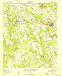
1950 Map of Wrens
USGS Topo · Published 1950About this map
Stapleton and Wrens anchor this mid-century landscape in Jefferson County, where the transition from agriculture to small-town commerce is documented through a dense network of country roads and community hubs. The area is defined by its integrated social centers, where education and faith often shared the same ground at sites like the Stone Springfield School Church and Cemetery and the Lofton School Church and Cemetery. These combined institutions, along with numerous windmills dotting the farms, reflect the self-sustaining nature of rural Georgia life just after the war.
Find a feature on this map
38 named features on this map. Tap any name to fly to it.
Don’t see what you’re looking for? This feature index may not catch every label — zoom into the map to look around manually.
Map Details
Editions of this 1950 Wrens Map
3 editions found
Other maps of this area

1920 · Stapleton
USGS Topo · 1:62,500

1922 · Harlem
USGS Topo · 1:62,500

1948 · Harlem
USGS Topo · 1:62,500

1948 · Stapleton
USGS Topo · 1:62,500

1948 · Louisville
USGS Topo · 1:24,000

1950 · Louisville
USGS Topo · 1:24,000

1950 · Wrens
USGS Topo · 1:24,000

1950 · Matthews
USGS Topo · 1:24,000
1950 · Bowdens Pond
USGS Topo · 1:24,000

1950 · Kellys Pond
USGS Topo · 1:24,000