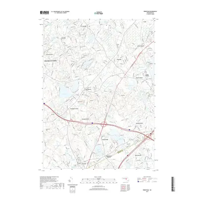
2018 Map of Wrentham
USGS Topo · Published 2018About this map
Wrentham sits at the heart of this Norfolk County landscape, surrounded by a dense network of suburban development and water bodies including Lake Pearl and Mirror Lake. The 2018 survey reveals the complex boundary where Norfolk Co meets Bristol Co, a line that cuts through the southern portion of the quadrangle near Plainville. Historically significant sites like the Center Cem in Wrentham and the South Burial Ground Cem offer clear points of interest for genealogical research. The terrain is marked by distinctive local landmarks such as Wampum Rock and Knuckup Hill, while the CSX rail line and major road corridors like the Boston-Providence Pke show the region's modern transportation infrastructure. Smaller settlements like City Mills, Shepardville, and Pondville maintain their distinct labels amidst the expanding residential footprint of Franklin Town.
Find a feature on this map
238 named features on this map. Tap any name to fly to it.
Don’t see what you’re looking for? This feature index may not catch every label — zoom into the map to look around manually.
Map Details
Editions of this 2018 Wrentham Map
This is the sole edition of this map. No revisions or reprints were ever made.
Other maps of this area

1885 · Taunton
USGS Topo · 1:62,500

1886 · Dedham
USGS Topo · 1:62,500

1887 · Franklin
USGS Topo · 1:62,500

1887 · Providence
USGS Topo · 1:62,500

1888 · Taunton
USGS Topo · 1:62,500

1889 · Providence
USGS Topo · 1:62,500

1889 · Franklin
USGS Topo · 1:62,500

1893 · Taunton
USGS Topo · 1:62,500

1893 · Franklin
USGS Topo · 1:62,500

1894 · Dedham
USGS Topo · 1:62,500