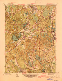
1940 Map of Wrentham
USGS Topo · Published 1940About this map
Wrentham sits at the heart of this 1930s landscape, serving as a hub for the region's transport and institutional history. The town is marked by significant state facilities, including the State School and the State Prison Colony near the Norfolk border, indicating the area's role in public service and administration at the time. To the east, Foxboro and South Walpole are connected by the New York New Haven and Hartford railroad, which provided essential links for industry and local travel. The terrain is defined by a series of kettle ponds and wetlands, such as Lake Pearl, Lake Archer, and the expansive Witch Pond Swamp. Local history is preserved in the names of old schoolhouses like Vogel Sch and Everett Sch, and several burial grounds including Terrace Hill Cem and the Quaker Cem. This survey illustrates the intricate balance between growing residential centers like Plainville and the preservation of large marshy tracts such as Cedar Swamp.
Find a feature on this map
69 named features on this map. Tap any name to fly to it.
Don’t see what you’re looking for? This feature index may not catch every label — zoom into the map to look around manually.
Map Details
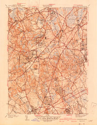
Editions of this 1940 Wrentham Map
2 editions found
Other maps of this area

1885 · Taunton
USGS Topo · 1:62,500

1886 · Dedham
USGS Topo · 1:62,500

1887 · Franklin
USGS Topo · 1:62,500

1887 · Providence
USGS Topo · 1:62,500

1888 · Taunton
USGS Topo · 1:62,500

1889 · Providence
USGS Topo · 1:62,500

1889 · Franklin
USGS Topo · 1:62,500

1893 · Taunton
USGS Topo · 1:62,500

1893 · Franklin
USGS Topo · 1:62,500

1894 · Dedham
USGS Topo · 1:62,500