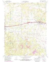
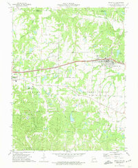
1972 Map of Wright City
USGS Topo · Published 1986About this map
Wright City and the neighboring community of Truesdale anchor this mid-1970s landscape, illustrating the development of Warren and Lincoln counties. The Norfolk and Western railroad corridor serves as the primary East-West axis, paralleling the interstate and connecting these hubs to the surrounding agricultural lands. Notable institutional landmarks such as the Passionist Fathers Seminary and the Warrenton-O'Sullivan Airport appear alongside older cultural markers, including the Wesley Ch Cem and the southern Harmonie Ch. To the south, the terrain shifts into the wooded hills of the Reifsnider State Forest, a landscape marked by numerous claypits and a quarry, indicating the local extraction economy. The drainage patterns of Indian Camp Creek and Peruque Creek define the topography, while rural life is mapped through a dense network of family-named roads like Pleasant Hill Road and Klausmeier Road.
Find a feature on this map
34 named features on this map. Tap any name to fly to it.
Don’t see what you’re looking for? This feature index may not catch every label — zoom into the map to look around manually.
Map Details
Editions of this 1972 Wright City Map
2 editions found
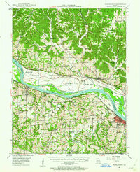
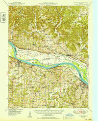
Other maps of this area

1890 · Hermann
USGS Topo · 1:125,000

1903 · O'Fallon
USGS Topo · 1:125,000

1941 · Troy
USGS Topo · 1:62,500

1943 · Warrenton
USGS Topo · 1:62,500

1945 · Troy
USGS Topo · 1:62,500

1945 · Warrenton
USGS Topo · 1:62,500
1948 · Washington
USGS Topo · 1:62,500

1948 · Augusta
USGS Topo · 1:62,500

1949 · Saint Louis
USGS Topo · 1:250,000
1949 · Washington
USGS Topo · 1:62,500