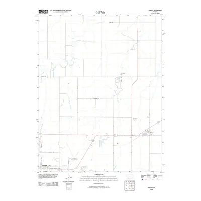
2010 Map of Wright
USGS Topo · Published 2010About this map
Dodge City is the anchor for this 2010 survey of the Kansas prairie, with its northeastern outskirts transitioning into the agricultural landscape of Ford County. The settlement of Wright sits at the junction of Jewell Rd and Doll St, representing the organized grid that defines this region. The terrain is marked by the branching paths of Duck Creek and its South Fork, as well as the north-south flow of Elm Creek. Water management is central to this landscape, as evidenced by the Ford County Dam and the adjacent Ford County Lake. This period of documentation captures the area's infrastructure, including the Dodge City Municipal Airport and the Pleasant Vale Cemetery, which serves as a quiet landmark amidst the surrounding farmland. The map also traces significant corridors such as E Wyatt Earp Blvd and Military Ave, reflecting the historic and modern transit routes of this iconic cattle-town region.
Find a feature on this map
30 named features on this map. Tap any name to fly to it.
Don’t see what you’re looking for? This feature index may not catch every label — zoom into the map to look around manually.
Map Details
Editions of this 2010 Wright Map
This is the sole edition of this map. No revisions or reprints were ever made.
Other maps of this area

1892 · Dodge
USGS Topo · 1:125,000

1892 · Spearville
USGS Topo · 1:125,000

1894 · Spearville
USGS Topo · 1:125,000

1955 · Pratt
USGS Topo · 1:250,000

1955 · Dodge City
USGS Topo · 1:250,000

1958 · Dodge City
USGS Topo · 1:250,000

1959 · Pratt
USGS Topo · 1:250,000

1959 · Dodge City
USGS Topo · 1:250,000

1968 · Dodge City NE
USGS Topo · 1:24,000

1968 · Dodge City
USGS Topo · 1:24,000