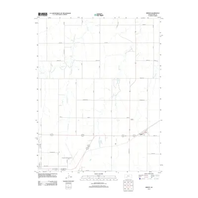
2012 Map of Wright
USGS Topo · Published 2012About this map
The unincorporated community of Wright serves as a focal point in this eastern Ford County landscape, situated where the grid of rural section roads meets the modern transportation corridors of U.S. Route 50 and Route 400. This survey illustrates a prairie environment defined by the winding paths of Duck Cr and its S Fork Duck Cr, as well as the drainage of Elm Cr. The northern reaches are dominated by large-scale agricultural blocks, while the southern section shows the infrastructure and expansion of the Dodge City Regional Airport. Local history is anchored by the Pleasant Vale Cem, located north of the primary thoroughfares, and the recreation area at Ford County Lake. The presence of Military Ave near the airport hints at the historical trail and road networks that have long intersected near the Dodge City area.
Find a feature on this map
39 named features on this map. Tap any name to fly to it.
Don’t see what you’re looking for? This feature index may not catch every label — zoom into the map to look around manually.
Map Details
Editions of this 2012 Wright Map
This is the sole edition of this map. No revisions or reprints were ever made.
Other maps of this area

1892 · Dodge
USGS Topo · 1:125,000

1892 · Spearville
USGS Topo · 1:125,000

1894 · Spearville
USGS Topo · 1:125,000

1955 · Pratt
USGS Topo · 1:250,000

1955 · Dodge City
USGS Topo · 1:250,000

1958 · Dodge City
USGS Topo · 1:250,000

1959 · Pratt
USGS Topo · 1:250,000

1959 · Dodge City
USGS Topo · 1:250,000

1968 · Dodge City NE
USGS Topo · 1:24,000

1968 · Dodge City
USGS Topo · 1:24,000