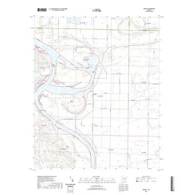
2020 Map of Wright
USGS Topo · Published 2020About this map
The Arkansas River carves a complex course through this portion of Jefferson and Pulaski Counties, defined by dramatic meanders and engineered navigation aids. The landscape is marked by prominent river features such as Brodie Bend, the Brodie Bend Cutoff, and the expansive Hensley Island. The settlement of Wright sits at a crossroads near the riverbank, serving as a focal point for the surrounding agricultural plains.
Find a feature on this map
81 named features on this map. Tap any name to fly to it.
Don’t see what you’re looking for? This feature index may not catch every label — zoom into the map to look around manually.
Map Details
Editions of this 2020 Wright Map
This is the sole edition of this map. No revisions or reprints were ever made.
Other maps of this area

1891 · Little Rock
USGS Topo · 1:125,000

1893 · Little Rock
USGS Topo · 1:125,000

1932 · Pastoria
USGS Topo · 1:62,500

1935 · Altheimer
USGS Topo · 1:62,500

1935 · Pastoria
USGS Topo · 1:62,500

1937 · England
USGS Topo · 1:48,000

1939 · Keo
USGS Topo · 1:31,680

1940 · Woodson
USGS Topo · 1:31,680

1941 · Keo
USGS Topo · 1:31,680

1943 · England
USGS Topo · 1:62,500