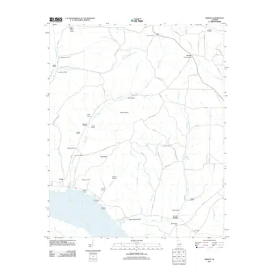
2011 Map of Wright
USGS Topo · Published 2011About this map
Gravelly Springs sits near the southern edge of this Tennessee River landscape, where the terrain transitions from the riverbank to the high ground of Rainbow Ridge and Texas Ridge. The settlement patterns here are defined by a network of hollows—such as Beckham Hollow, Lester Hollow, and Bolling Spring Hollow—that dictate the flow of smaller tributaries like Brush Creek and Bluff Creek. This early 21st-century survey documents a rural environment structured around small crossroads communities like Murphy Cross Roads and Dart, the latter featuring the Dart Post Office. Genealogists will find significant local value in the recorded burial sites, including the Francis-King-Lucas Cemetery in the northeast and Milford Cemetery near the center of the sheet. The presence of features like Long Branch Crossing and Pettipoole Hill suggests a landscape where local navigation and geography remain deeply tied to long-standing family names and natural landmarks.
Find a feature on this map
79 named features on this map. Tap any name to fly to it.
Don’t see what you’re looking for? This feature index may not catch every label — zoom into the map to look around manually.
Map Details
Editions of this 2011 Wright Map
This is the sole edition of this map. No revisions or reprints were ever made.
Other maps of this area

1905 · Waynesboro
USGS Topo · 1:125,000

1911 · Iuka
USGS Topo · 1:48,000

1914 · Iuka
USGS Topo · 1:62,500

1924 · Gravelly Springs
USGS Topo · 1:48,000

1926 · Gravelly Springs
USGS Topo · 1:62,500

1935 · Cherokee
USGS Topo · 1:24,000

1935 · Wright
USGS Topo · 1:24,000

1936 · Margerum
USGS Topo · 1:24,000

1936 · Waterloo
USGS Topo · 1:24,000

1936 · Threet
USGS Topo · 1:24,000