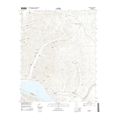
2014 Map of Wright
USGS Topo · Published 2014About this map
Gravelly Springs sits near the northern shoreline of Pickwick Lake, where the Tennessee River defines the southern boundary of this northwest Alabama landscape. The topography is dominated by an intricate system of ridges and hollows, including Rainbow Ridge and Texas Ridge, which separate numerous seasonal drainages like Troublesome Hollow Br and Brush Cr. This 2014 survey documents the enduring rural character of Lauderdale County, tracing the network of county roads that connect small settlements such as Wright and Murphy Cross Roads. Genealogy and local history researchers will find significant value in the mapped locations of family and community burial sites, including Milford Cem, Sharp Cem, and the Francis-King Lucas Cem near the northern border. To the southeast, the modern Natchez Trace Pky cuts through the terrain, following the historical travel corridor near Bluff Creek Hill.
Find a feature on this map
80 named features on this map. Tap any name to fly to it.
Don’t see what you’re looking for? This feature index may not catch every label — zoom into the map to look around manually.
Map Details
Editions of this 2014 Wright Map
This is the sole edition of this map. No revisions or reprints were ever made.
Other maps of this area

1905 · Waynesboro
USGS Topo · 1:125,000

1911 · Iuka
USGS Topo · 1:48,000

1914 · Iuka
USGS Topo · 1:62,500

1924 · Gravelly Springs
USGS Topo · 1:48,000

1926 · Gravelly Springs
USGS Topo · 1:62,500

1935 · Cherokee
USGS Topo · 1:24,000

1935 · Wright
USGS Topo · 1:24,000

1936 · Margerum
USGS Topo · 1:24,000

1936 · Waterloo
USGS Topo · 1:24,000

1936 · Threet
USGS Topo · 1:24,000