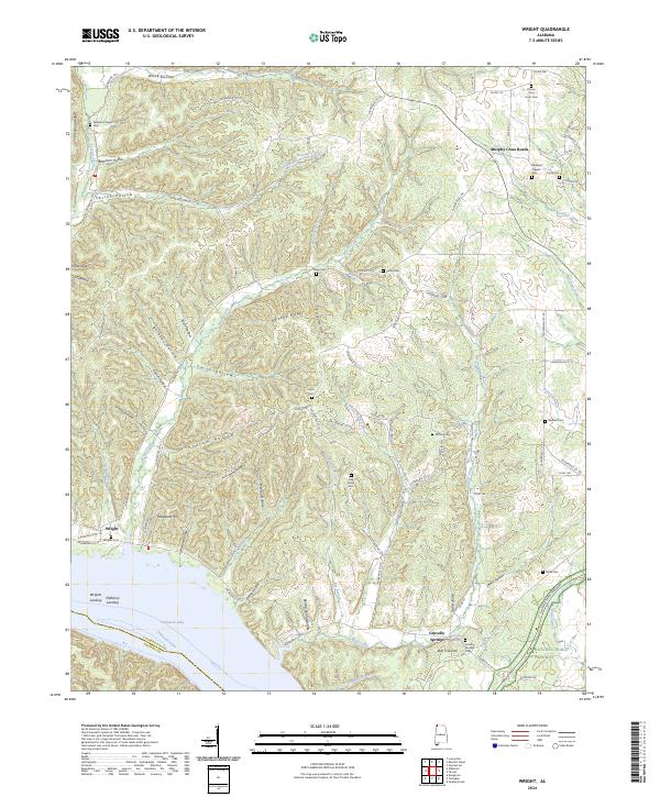
2024 Map of Wright
USGS Topo · Published 2024About this map
Pickwick Lake and the Tennessee River define the southern landscape of this Lauderdale County terrain, where the water's edge meets a complex system of ridges and hollows. The area around Wright and Gravelly Springs preserves a high density of small family and community burial grounds, including the Francis King-Lucas Cem and Murphys Chapel Cem, providing significant spatial data for genealogical research.
Find a feature on this map
107 named features on this map. Tap any name to fly to it.
Don’t see what you’re looking for? This feature index may not catch every label — zoom into the map to look around manually.
Map Details
Editions of this 2024 Wright Map
This is the sole edition of this map. No revisions or reprints were ever made.
Other maps of this area

1905 · Waynesboro
USGS Topo · 1:125,000

1911 · Iuka
USGS Topo · 1:48,000

1914 · Iuka
USGS Topo · 1:62,500

1924 · Gravelly Springs
USGS Topo · 1:48,000

1926 · Gravelly Springs
USGS Topo · 1:62,500

1935 · Cherokee
USGS Topo · 1:24,000

1935 · Wright
USGS Topo · 1:24,000

1936 · Margerum
USGS Topo · 1:24,000

1936 · Waterloo
USGS Topo · 1:24,000

1936 · Threet
USGS Topo · 1:24,000