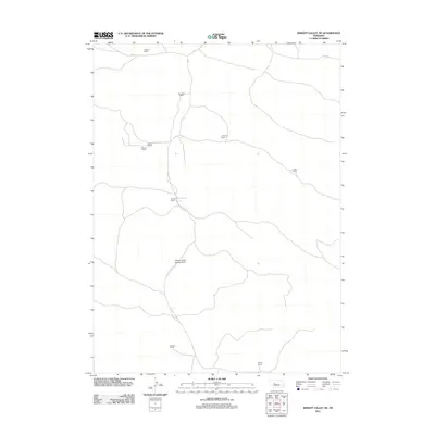
2011 Map of Wright Valley NE
USGS Topo · Published 2011About this map
Pioneer Ranch and several other family-held ranching operations define this portion of the Nebraska Sandhills in the early twenty-first century. The map reveals a land usage pattern dominated by large-scale grazing tracts, where the distance between homesteads like Moore Ranch and Calhoun Ranch reflects the expansive nature of the region's agricultural economy. This 2011 survey documents the sparse network of local roads and paths that connect these remote outposts, including the private Pioneer Ranch Landing Strip, which serves as a vital transportation link in this sparsely populated landscape. Other notable holdings recorded include the R Connell Ranch, H Connell Ranch, and the Wisner Ranch to the south. The absence of traditional town centers emphasizes the character of this territory as a working ranching district where family names are the primary geographic identifiers.
Find a feature on this map
10 named features on this map. Tap any name to fly to it.
Don’t see what you’re looking for? This feature index may not catch every label — zoom into the map to look around manually.
Map Details
Editions of this 2011 Wright Valley NE Map
This is the sole edition of this map. No revisions or reprints were ever made.
Other maps of this area

1947 · Dismal River Ranch
USGS Topo · 1:62,500

1949 · Dismal River Ranch
USGS Topo · 1:62,500

1949 · Wright Valley
USGS Topo · 1:62,500

1950 · Shimmins Lake
USGS Topo · 1:62,500

1951 · Tryon
USGS Topo · 1:62,500

1951 · Wright Valley
USGS Topo · 1:62,500

1954 · North Platte
USGS Topo · 1:250,000

1956 · North Platte
USGS Topo · 1:250,000

1957 · North Platte
USGS Topo · 1:250,000

1967 · North Platte
USGS Topo · 1:250,000