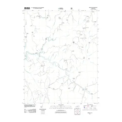
2011 Map of Wrigley
USGS Topo · Published 2011About this map
The North Fork Licking River carves through a landscape defined by deep ridges and hollows in this 2011 Kentucky survey. Small settlements like Wrigley, Blaze, and Craney are connected by a web of narrow roads such as Yokum-Blaze-Ditney Ridge Rd. The map is particularly notable for its dense concentration of family burial grounds, including the Kidd-White Cemetery, G W Hall Cemetery, and Prather-Stamper Cemetery, which offer significant value for genealogical research. The geography is characterized by distinct terrain features such as Winding Stairs, Black Cave Hollow, and Alderson Ridge. These labels, combined with the presence of the Wrigley Post Office and Blairs Mills, illustrate a rural community structure where life and movement are dictated by the winding watercourses and the high ground of places like Crix Ridge and Fraley Ridge.
Find a feature on this map
100 named features on this map. Tap any name to fly to it.
Don’t see what you’re looking for? This feature index may not catch every label — zoom into the map to look around manually.
Map Details
Editions of this 2011 Wrigley Map
This is the sole edition of this map. No revisions or reprints were ever made.
Other maps of this area

1889 · Salyersville
USGS Topo · 1:125,000

1891 · Salyersville
USGS Topo · 1:125,000

1899 · Salyersville
USGS Topo · 1:125,000

1929 · Morehead
USGS Topo · 1:48,000

1935 · Morehead
USGS Topo · 1:62,500

1950 · Ault
USGS Topo · 1:24,000

1950 · Sandy Hook
USGS Topo · 1:24,000

1950 · Lenox
USGS Topo · 1:24,000

1951 · Ezel
USGS Topo · 1:24,000
1951 · Lenox
USGS Topo · 1:24,000