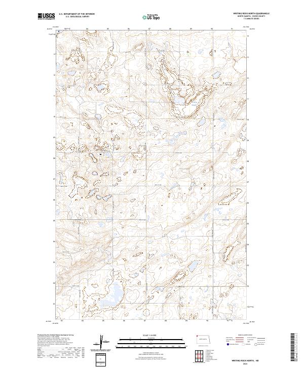
2024 Map of Writing Rock North
USGS Topo · Published 2024About this map
Divide County Waterfowl Production Area dominates the high plains of this township, reflecting the modern conservation efforts in the prairie pothole region of Divide County. The landscape is dotted with numerous small wetlands and basins typical of the glaciated plains, including Marsland Slough near the eastern boundary. The grid of section roads, including 144th Ave NW and 93rd St NW, provides access to these managed lands and local farms. For those researching family history in this corner of North Dakota, the Writing Rock Cem serves as a significant local landmark, situated along 97th St NW. The map illustrates a region defined by its rural character and the vital presence of waterfowl habitat alongside a sparse but enduring network of county roads like Co Rd 7.
Find a feature on this map
22 named features on this map. Tap any name to fly to it.
Don’t see what you’re looking for? This feature index may not catch every label — zoom into the map to look around manually.
Map Details
Editions of this 2024 Writing Rock North Map
This is the sole edition of this map. No revisions or reprints were ever made.
Other maps of this area

1948 · Stady
USGS Topo · 1:24,000

1953 · Williston
USGS Topo · 1:250,000

1957 · Williston
USGS Topo · 1:250,000

1983 · Colgan West
USGS Topo · 1:24,000

1983 · Writing Rock North
USGS Topo · 1:24,000

1983 · Alkabo
USGS Topo · 1:24,000

1983 · Alexandria
USGS Topo · 1:24,000

1983 · Writing Rock South
USGS Topo · 1:24,000
1983 · Fortuna
USGS Topo · 1:24,000
1983 · Skjermo Lake
USGS Topo · 1:24,000