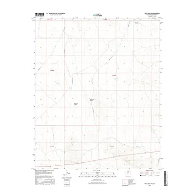
2017 Map of Wrye Peak NW
USGS Topo · Published 2017About this map
Wash Hale Canyon and Hoot Owl Canyon carve through this high-desert landscape in northern Socorro County, reflecting a terrain shaped by intermittent drainage and arid-land ranching. This 2017 study illustrates a network of utility and access routes, including WSMR S Route 3509 and WSMR S Route 3610, which crisscross the expansive rangelands. The presence of water management features such as Glover Tank, Morton Tank, and Washtub Tank indicates the essential infrastructure required for managing livestock in this environment. Situated within various townships including t4s r4e and t4s r5e, the area remains sparsely developed, characterized primarily by these catchment basins and canyons.
Find a feature on this map
16 named features on this map. Tap any name to fly to it.
Don’t see what you’re looking for? This feature index may not catch every label — zoom into the map to look around manually.
Map Details
Editions of this 2017 Wrye Peak NW Map
This is the sole edition of this map. No revisions or reprints were ever made.
Other maps of this area

1916 · La Joya
USGS Topo · 1:125,000

1918 · Oscura Peak
USGS Topo · 1:125,000

1948 · Carthage
USGS Topo · 1:62,500

1948 · Bingham
USGS Topo · 1:62,500

1954 · Tularosa
USGS Topo · 1:250,000

1954 · Socorro
USGS Topo · 1:250,000

1958 · Socorro
USGS Topo · 1:250,000

1958 · Tularosa
USGS Topo · 1:250,000

1962 · Socorro
USGS Topo · 1:250,000

1972 · Wilson Ranch
USGS Topo · 1:24,000