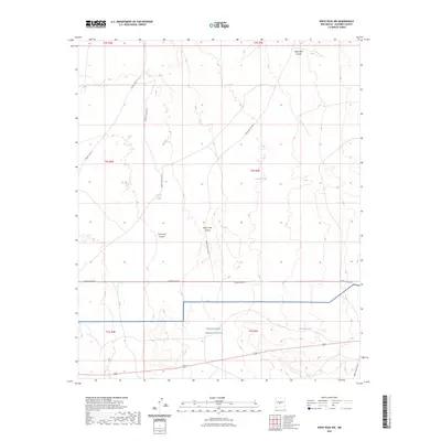
2023 Map of Wrye Peak NW
USGS Topo · Published 2023About this map
The White Sands Missile Range dominates the southern portion of this landscape, reflecting its modern role as part of a significant military installation in Socorro County. The terrain is defined by a series of north-south canyons, including Mesa Well Canyon, Wash Hale Canyon, and Hoot Owl Canyon, which dictate the drainage patterns across the arid basin. Water management is evidenced by distributed improvements such as Glover Tank, Morton Tank, and Washtub Tank, essential infrastructure for land use in this dry environment. Transport is restricted to a grid of named military routes, including WSMR P Route 41 and WSMR S Route 3610, which connect the remote sections of the range while following the natural contours of the basin floor.
Find a feature on this map
21 named features on this map. Tap any name to fly to it.
Don’t see what you’re looking for? This feature index may not catch every label — zoom into the map to look around manually.
Map Details
Editions of this 2023 Wrye Peak NW Map
This is the sole edition of this map. No revisions or reprints were ever made.
Other maps of this area

1916 · La Joya
USGS Topo · 1:125,000

1918 · Oscura Peak
USGS Topo · 1:125,000

1948 · Carthage
USGS Topo · 1:62,500

1948 · Bingham
USGS Topo · 1:62,500

1954 · Tularosa
USGS Topo · 1:250,000

1954 · Socorro
USGS Topo · 1:250,000

1958 · Socorro
USGS Topo · 1:250,000

1958 · Tularosa
USGS Topo · 1:250,000

1962 · Socorro
USGS Topo · 1:250,000

1972 · Wilson Ranch
USGS Topo · 1:24,000