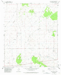
1981 Map of Wrye Peak NW
USGS Topo · Published 1982About this map
Bingham PO serves as the primary landmark in this high-desert region of Socorro County, where survival and settlement are tied to a complex network of water features. The landscape is defined by its drainage patterns, notably Hale Canyon, Yellow Dog Canyon, and the Chupadera Arroyo, which cut through the arid terrain. Ranching infrastructure is pervasive, documented through numerous named water sources such as White Well, Myer Well, West Well, and Glover Well. These features, alongside specialized structures like Washtub Tank and Morton Tank, indicate a land managed for livestock in the early 1980s. Connectivity across this desert environment is limited to a few improved roads and a primitive Jeep Trail, illustrating the isolation of this corner of New Mexico during the late twentieth century.
Find a feature on this map
23 named features on this map. Tap any name to fly to it.
Don’t see what you’re looking for? This feature index may not catch every label — zoom into the map to look around manually.
Map Details
Editions of this 1981 Wrye Peak NW Map
This is the sole edition of this map. No revisions or reprints were ever made.
Other maps of this area

1916 · La Joya
USGS Topo · 1:125,000

1918 · Oscura Peak
USGS Topo · 1:125,000

1948 · Carthage
USGS Topo · 1:62,500

1948 · Bingham
USGS Topo · 1:62,500

1954 · Tularosa
USGS Topo · 1:250,000

1954 · Socorro
USGS Topo · 1:250,000

1958 · Socorro
USGS Topo · 1:250,000

1958 · Tularosa
USGS Topo · 1:250,000

1962 · Socorro
USGS Topo · 1:250,000

1972 · Wilson Ranch
USGS Topo · 1:24,000