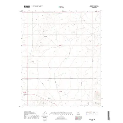
2020 Map of Wrye Peak
USGS Topo · Published 2020About this map
Bingham sits in the southwestern corner of this high desert landscape, representing a remote outpost in Socorro County. The terrain is defined by dramatic elevation changes, rising from the canyons to the prominent heights of Wrye Peak and the southern reaches of Chupadera Mesa. This 2020 survey reveals an arid environment where water management is central to the land's utility, evidenced by a network of catchments such as O'Neal Tank, Lucero Tank, and Pinto Tank. The naming conventions found here, from Hoot Owl Canyon to Wash Hale Canyon, reflect a history of ranching and frontier life. Transportation across this portion of the White Sands Missile Range periphery is facilitated by restricted routes like WSMR P Route 41, while Cedar Pass and Antelope Mound serve as natural landmarks for navigating the high-altitude topography.
Find a feature on this map
29 named features on this map. Tap any name to fly to it.
Don’t see what you’re looking for? This feature index may not catch every label — zoom into the map to look around manually.
Map Details
Editions of this 2020 Wrye Peak Map
This is the sole edition of this map. No revisions or reprints were ever made.
Other maps of this area

1918 · Oscura Peak
USGS Topo · 1:125,000

1948 · Broken Back Crater
USGS Topo · 1:62,500

1948 · Bingham
USGS Topo · 1:62,500

1954 · Tularosa
USGS Topo · 1:250,000

1954 · Socorro
USGS Topo · 1:250,000

1958 · Socorro
USGS Topo · 1:250,000

1958 · Tularosa
USGS Topo · 1:250,000

1962 · Socorro
USGS Topo · 1:250,000

1972 · Turkey Ridge SW
USGS Topo · 1:24,000

1972 · Wilson Ranch
USGS Topo · 1:24,000