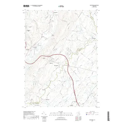
2019 Map of Wurtsboro
USGS Topo · Published 2019About this map
The Shawangunk Mountains define the western geography of this corridor, where the valley floor transitions between Sullivan and Orange counties. The village of Wurtsboro sits at the foot of the ridge, while the Wurtsboro-Sullivan County Airport and the waters of the Basher Kill occupy the lowlands to the east. This landscape is a patchwork of small communities like Bloomingburg, Summitville, and Winterton, connected by historic routes including the Co Rd 172 and Roosa Gap Rd.
Find a feature on this map
157 named features on this map. Tap any name to fly to it.
Don’t see what you’re looking for? This feature index may not catch every label — zoom into the map to look around manually.
Map Details
Editions of this 2019 Wurtsboro Map
This is the sole edition of this map. No revisions or reprints were ever made.
Other maps of this area

1904 · Ellenville
USGS Topo · 1:62,500

1906 · Ellenville
USGS Topo · 1:62,500

1906 · Port Jervis
USGS Topo · 1:62,500

1906 · Goshen
USGS Topo · 1:62,500

1908 · Goshen
USGS Topo · 1:62,500

1908 · Port Jervis
USGS Topo · 1:62,500

1909 · Monticello
USGS Topo · 1:62,500

1911 · Monticello
USGS Topo · 1:62,500

1938 · Goshen
USGS Topo · 1:62,500

1942 · Goshen
USGS Topo · 1:24,000