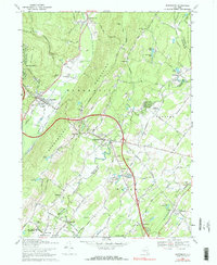
1969 Map of Wurtsboro
USGS Topo · Published 1990About this map
The Shawangunk Ridge dominates this 1969 landscape, where the historical corridor of the Delaware and Hudson Canal and the Delaware and Hudson Railroad follow the base of the mountains through Wurtsboro. This area shows a transition from early industrial transport to a mid-century aviation and recreation hub, evidenced by the Wurtsboro-Sullivan Co Airport and the American Legion Camp near Echo Lake.
Find a feature on this map
74 named features on this map. Tap any name to fly to it.
Don’t see what you’re looking for? This feature index may not catch every label — zoom into the map to look around manually.
Map Details
Editions of this 1969 Wurtsboro Map
3 editions found
Other maps of this area

1904 · Ellenville
USGS Topo · 1:62,500

1906 · Ellenville
USGS Topo · 1:62,500

1906 · Port Jervis
USGS Topo · 1:62,500

1906 · Goshen
USGS Topo · 1:62,500

1908 · Goshen
USGS Topo · 1:62,500

1908 · Port Jervis
USGS Topo · 1:62,500

1909 · Monticello
USGS Topo · 1:62,500

1911 · Monticello
USGS Topo · 1:62,500

1938 · Goshen
USGS Topo · 1:62,500

1942 · Goshen
USGS Topo · 1:24,000