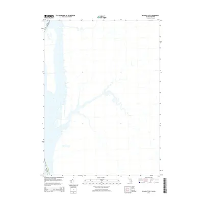
2014 Map of Wyandotte OE E
USGS Topo · Published 2014About this map
The international border between Usa and Canada defines this 2014 survey of the Wyandotte OE E quadrangle. This hydrographic study focuses on the complex water channels and marshy terrain of the Detroit River system as it flows toward Lake Erie. The map provides a high-resolution look at the intricate coastline, islands, and secondary waterways that separate Michigan from Ontario. Unlike many terrestrial topo sheets, the emphasis here is on the liquid geography and the political boundary that bisects it. This document is essential for researchers tracking the modern state of the riverbanks and the jurisdictional division of the waterway in the early 21st century.
Find a feature on this map
1 named feature on this map. Tap any name to fly to it.
Don’t see what you’re looking for? This feature index may not catch every label — zoom into the map to look around manually.
Map Details
Editions of this 2014 Wyandotte OE E Map
This is the sole edition of this map. No revisions or reprints were ever made.
Other maps of this area

1905 · Detroit
USGS Topo · 1:62,500

1905 · Grosse Pointe
USGS Topo · 1:62,500

1906 · Wyandotte
USGS Topo · 1:62,500

1912 · Wyandotte
USGS Topo · 1:62,500

1918 · Detroit
USGS Topo · 1:62,500

1918 · Grosse Pointe
USGS Topo · 1:62,500

1924 · Detroit
USGS Topo · 1:62,500

1929 · Wyandotte
USGS Topo · 1:62,500

1934 · Detroit
USGS Topo · 1:62,500

1936 · Wyandotte
USGS Topo · 1:31,680