
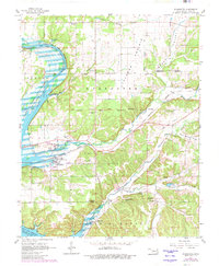
1961 Map of Wyandotte
USGS Topo · Published 1963About this map
Wyandotte serves as a central hub on this 1961 survey, situated where the St Louis San Francisco railroad crosses the terrain near the confluence of the Spring River and Neosho River. The landscape is heavily defined by tribal history, with numerous administrative and geographic boundaries visible including the Ottawa Indian Reservation Boundary, the East Shawnee Indian Reservation Boundary, and the Shawnee Modoc Indian Reservation Boundary.
Find a feature on this map
39 named features on this map. Tap any name to fly to it.
Don’t see what you’re looking for? This feature index may not catch every label — zoom into the map to look around manually.
Map Details
Editions of this 1961 Wyandotte Map
2 editions found
Other maps of this area

1907 · Wyandotte
USGS Topo · 1:125,000

1909 · Wyandotte
USGS Topo · 1:125,000

1949 · Seneca
USGS Topo · 1:24,000

1949 · Racine
USGS Topo · 1:24,000

1950 · Seneca
USGS Topo · 1:24,000

1950 · Racine
USGS Topo · 1:24,000

1954 · Tulsa
USGS Topo · 1:250,000

1958 · Tulsa
USGS Topo · 1:250,000
1960 · Peoria
USGS Topo · 1:24,000

1961 · Miami SE
USGS Topo · 1:24,000