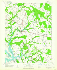
1942 Map of Wye Mills
USGS Topo · Published 1961About this map
The boundary between Queen Anne's and Talbot counties is defined by the winding waters of Skipton Creek and the Wye River during the early 1940s. At the center of this agricultural and maritime landscape lies Wye Mills, a local hub situated near the preserved Wye Oak State Park. The map documents a deeply rooted rural community, anchored by numerous spiritual and educational sites such as Old Wye Ch, Old St Joseph Ch, and St Pauls Ch, alongside local institutions like Carmichael Sch and Newton Sch. Transportation in the era relied on the Baltimore and Eastern railroad, which provided a terrestrial link between small inland settlements like Willoughby and the coastal access found at Wye Landing. The complex geography of the shoreline is illustrated through the branching of the Wye East River and the passage of the Wye Narrows around Wye Island.
Find a feature on this map
20 named features on this map. Tap any name to fly to it.
Don’t see what you’re looking for? This feature index may not catch every label — zoom into the map to look around manually.
Map Details
Editions of this 1942 Wye Mills Map
2 editions found
Other maps of this area

1898 · Choptank
USGS Topo · 1:125,000

1898 · Tolchester
USGS Topo · 1:125,000

1899 · Dover
USGS Topo · 1:125,000

1901 · Chestertown
USGS Topo · 1:62,500

1903 · Tolchester
USGS Topo · 1:125,000

1904 · St. Michaels
USGS Topo · 1:62,500

1905 · Denton
USGS Topo · 1:62,500

1905 · Barclay
USGS Topo · 1:62,500

1906 · Dover
USGS Topo · 1:125,000

1908 · Tolchester
USGS Topo · 1:125,000