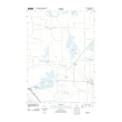
2010 Map of Wyeville
USGS Topo · Published 2010About this map
Valley Junction and Wyeville anchor this Monroe County landscape at a point where the East Fork Lemonweir River and South Fork Lemonweir River define the local hydrology. The area is characterized by a complex network of managed waterways and wetlands, evidenced by the North Tomah Cranberry Company 3WR483 Dam and several reservoirs like Lake 32 11 57. The distribution of burial sites, including Dannavang Cemetery and Wood Cemetery, suggests the placement of early rural communities near the banks of Lowry Creek and Mill Creek. This 2010 survey reflects a region where water management for agriculture, specifically cranberry production, is a primary driver of the terrain's modification. Smaller tributaries such as Sand Creek, Dead Creek, and Kreyer Creek weave through a grid of county highways and local roads like County Hwy-N and Estate Rd.
Find a feature on this map
58 named features on this map. Tap any name to fly to it.
Don’t see what you’re looking for? This feature index may not catch every label — zoom into the map to look around manually.
Map Details
Editions of this 2010 Wyeville Map
This is the sole edition of this map. No revisions or reprints were ever made.
Other maps of this area

1916 · Tomah
USGS Topo · 1:62,500

1919 · Kendall
USGS Topo · 1:62,500

1921 · Kendall
USGS Topo · 1:62,500

1947 · Millston
USGS Topo · 1:62,500

1949 · Millston
USGS Topo · 1:62,500

1949 · Tomah
USGS Topo · 1:62,500

1953 · Eau Claire
USGS Topo · 1:250,000

1958 · Eau Claire
USGS Topo · 1:250,000

1958 · Wyeville
USGS Topo · 1:48,000

1958 · La Crosse
USGS Topo · 1:250,000