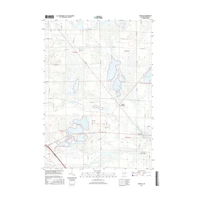
2015 Map of Wyeville
USGS Topo · Published 2015About this map
Valley Junction and Wyeville anchor this Monroe County landscape, characterized by an intricate network of waterways and wetlands. The drainage of the East Fork Lemonweir River and S Fork Lemonweir River dominates the terrain, supporting local landmarks like the Monroe County Flowage and Water Mill Pond. The region's agricultural and logistical identity is evident through the presence of the Prehn Cranberry Company Airport, situated just south of Wyeville near Mud Creek. Genealogists will find interest in the documented locations of Dannavang Cemetery in the north and Wood Cemetery near the center of the quadrangle. A dense grid of roads, such as County Highway G and Copper Road, connects these small settlements, reflecting the mid-20th-century development of this central Wisconsin intersection where the forks of the Lemonweir meet.
Find a feature on this map
55 named features on this map. Tap any name to fly to it.
Don’t see what you’re looking for? This feature index may not catch every label — zoom into the map to look around manually.
Map Details
Editions of this 2015 Wyeville Map
This is the sole edition of this map. No revisions or reprints were ever made.
Other maps of this area

1916 · Tomah
USGS Topo · 1:62,500

1919 · Kendall
USGS Topo · 1:62,500

1921 · Kendall
USGS Topo · 1:62,500

1947 · Millston
USGS Topo · 1:62,500

1949 · Millston
USGS Topo · 1:62,500

1949 · Tomah
USGS Topo · 1:62,500

1953 · Eau Claire
USGS Topo · 1:250,000

1958 · Eau Claire
USGS Topo · 1:250,000

1958 · Wyeville
USGS Topo · 1:48,000

1958 · La Crosse
USGS Topo · 1:250,000