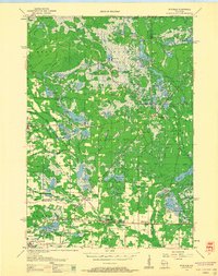
1958 Map of Wyeville
USGS Topo · Published 1960About this map
The Lemonweir River and its numerous tributaries define the wet, lowland landscape of central Wisconsin during the late 1950s. The region is characterized by an extensive system of managed water bodies and agricultural bogs, including the Potters Flowage, Beaver Flowage, and numerous designated Cranberry Bogs. This specialized hydraulic landscape supports local industry and dictates the placement of settlements like Wyeville and Valley Junction, which serve as hubs for the Chicago and North Western railway lines.
Find a feature on this map
59 named features on this map. Tap any name to fly to it.
Don’t see what you’re looking for? This feature index may not catch every label — zoom into the map to look around manually.
Map Details
Editions of this 1958 Wyeville Map
This is the sole edition of this map. No revisions or reprints were ever made.
Other maps of this area
1916 · Tomah
USGS Topo · 1:62,500
1919 · Kendall
USGS Topo · 1:62,500
1921 · Mauston
USGS Topo · 1:62,500
1921 · Kendall
USGS Topo · 1:62,500
1947 · Millston
USGS Topo · 1:62,500
1949 · Millston
USGS Topo · 1:62,500
1949 · Tomah
USGS Topo · 1:62,500

1953 · Eau Claire
USGS Topo · 1:250,000
1957 · Pittsville
USGS Topo · 1:48,000
1957 · City Point
USGS Topo · 1:48,000