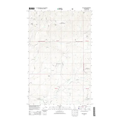
2013 Map of Wylie Knob
USGS Topo · Published 2013About this map
Cabinet Mountains geography dominates this 2013 survey of northeastern Idaho, where the Kanisku National Forest covers high-altitude peaks and drainage basins. Prominent summits like Wylie Knob, Lightning Peak, and Grouse Mtn mark the rugged interior, while Gold Ridge suggests the historical prospecting and mining heritage found in these ranges. The hydrology is defined by a dense network of mountain streams, including Grouse Cr, where Grouse Creek Falls is located, and the Rapid Lightning Cr system to the south.
Find a feature on this map
88 named features on this map. Tap any name to fly to it.
Don’t see what you’re looking for? This feature index may not catch every label — zoom into the map to look around manually.
Map Details
Editions of this 2013 Wylie Knob Map
This is the sole edition of this map. No revisions or reprints were ever made.
Other maps of this area

1911 · Priest Lake
USGS Topo · 1:250,000

1913 · Priest Lake
USGS Topo · 1:250,000

1951 · Mt Pend Oreille
USGS Topo · 1:62,500

1951 · Elmira
USGS Topo · 1:62,500

1958 · Sandpoint
USGS Topo · 1:250,000

1963 · Sandpoint
USGS Topo · 1:250,000

1965 · Twentymile Creek
USGS Topo · 1:24,000

1965 · Naples
USGS Topo · 1:24,000
1965 · Clifty Mtn
USGS Topo · 1:24,000
1983 · Bonners Ferry
USGS Topo · 1:100,000