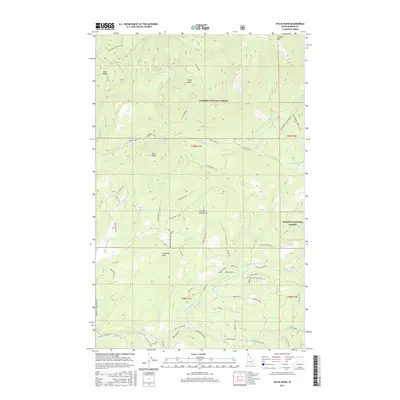
2017 Map of Wylie Knob
USGS Topo · Published 2017About this map
The Kaniksu National Forest defines the character of this Idaho terrain, where the crests of the Cabinet Mountains and Gold Ridge separate deep drainage basins. High peaks like Wylie Knob, Lightning Peak, and Grouse Mtn overlook a complex network of waterways, including the Grouse Creek Falls and the headwaters of Rapid Lightning Cr.
Find a feature on this map
67 named features on this map. Tap any name to fly to it.
Don’t see what you’re looking for? This feature index may not catch every label — zoom into the map to look around manually.
Map Details
Editions of this 2017 Wylie Knob Map
This is the sole edition of this map. No revisions or reprints were ever made.
Other maps of this area

1911 · Priest Lake
USGS Topo · 1:250,000

1913 · Priest Lake
USGS Topo · 1:250,000

1951 · Mt Pend Oreille
USGS Topo · 1:62,500

1951 · Elmira
USGS Topo · 1:62,500

1958 · Sandpoint
USGS Topo · 1:250,000

1963 · Sandpoint
USGS Topo · 1:250,000

1965 · Twentymile Creek
USGS Topo · 1:24,000

1965 · Naples
USGS Topo · 1:24,000
1965 · Clifty Mtn
USGS Topo · 1:24,000
1983 · Bonners Ferry
USGS Topo · 1:100,000