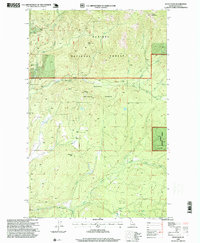
1996 Map of Wylie Knob
USGS Topo · Published 1999About this map
Kaniksu National Forest dominates this northern Idaho landscape, defined by a complex network of drainages and high ridgelines in the mid-1990s. The terrain is anchored by several prominent summits, including Wylie Knob and Lightning Peak, which overlook the deeply carved valleys of Grouse Creek and Rapid Lightning Creek. The presence of Gravel Pits in the southern portion of the sheet suggests active land use and resource extraction amidst the protected forest boundaries. This survey records the specific hydrological patterns of the era, such as the Grouse Creek Falls and the convergence of numerous named mountain streams like Bodenstein Creek and Trapper Creek. The map provides a detailed look at the interface between the high Sand Ridge and the lower basin drainages that feed the region's river systems.
Find a feature on this map
25 named features on this map. Tap any name to fly to it.
Don’t see what you’re looking for? This feature index may not catch every label — zoom into the map to look around manually.
Map Details
Editions of this 1996 Wylie Knob Map
This is the sole edition of this map. No revisions or reprints were ever made.
Other maps of this area

1911 · Priest Lake
USGS Topo · 1:250,000

1913 · Priest Lake
USGS Topo · 1:250,000

1951 · Mt Pend Oreille
USGS Topo · 1:62,500

1951 · Elmira
USGS Topo · 1:62,500

1958 · Sandpoint
USGS Topo · 1:250,000

1963 · Sandpoint
USGS Topo · 1:250,000

1965 · Twentymile Creek
USGS Topo · 1:24,000

1965 · Naples
USGS Topo · 1:24,000
1965 · Clifty Mtn
USGS Topo · 1:24,000
1983 · Bonners Ferry
USGS Topo · 1:100,000