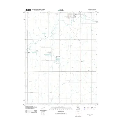
2011 Map of Wymore
USGS Topo · Published 2011About this map
The Big Blue River winds through the northeast corner of this landscape, anchoring the settlement of Wymore, where the Wymore Post Office serves the local community. This area along the Nebraska-Kansas border is defined by a sophisticated system of water management, evidenced by several reservoirs and dams such as Big Indian Creek Reservoir 11-B and Big Indian Creek Dam 2-A. These features suggest a landscape deeply involved in agricultural irrigation and flood control during the early 21st century.
Find a feature on this map
38 named features on this map. Tap any name to fly to it.
Don’t see what you’re looking for? This feature index may not catch every label — zoom into the map to look around manually.
Map Details
Editions of this 2011 Wymore Map
This is the sole edition of this map. No revisions or reprints were ever made.
Other maps of this area

1889 · Marysville
USGS Topo · 1:125,000

1894 · Marysville
USGS Topo · 1:125,000

1955 · Manhattan
USGS Topo · 1:250,000

1955 · Lincoln
USGS Topo · 1:250,000

1956 · Manhattan
USGS Topo · 1:250,000

1957 · Manhattan
USGS Topo · 1:250,000

1957 · Lincoln
USGS Topo · 1:250,000

1958 · Lincoln
USGS Topo · 1:250,000

1964 · Blue Springs
USGS Topo · 1:24,000

1966 · Oketo
USGS Topo · 1:24,000